
NSTA Professional Development Trip: Part VI
By Rob McNeely
Posted on 2012-07-31
Arenal to Monteverde
NSTA Costa Rica Trip Day 7
July 29, 2012
(posted on behalf of Greg Neff)
Arenal erupted on July 29, 1969. This eruption occurred on the north side of the volcano and killed approximately 80 people. The pyroclastic material from the eruption spewed and flowed mainly into a natural basin area where the town of Arenal was located. After the eruption survivors no longer wanted to live in the area. The Costa Rican (CR) government, obtained all the land in the basin area, and in 1977, 9 years after the eruption, built a dam to flood the basin. This created lake Arenal with a size of 40 km long and as wide as 6 km in some areas. The lake originally provided 50 percent of the electrical needs for CR. Demand for energy has increased, so today the Arenal hydroelectric facilities can only provide approximately 40 percent of current needs. 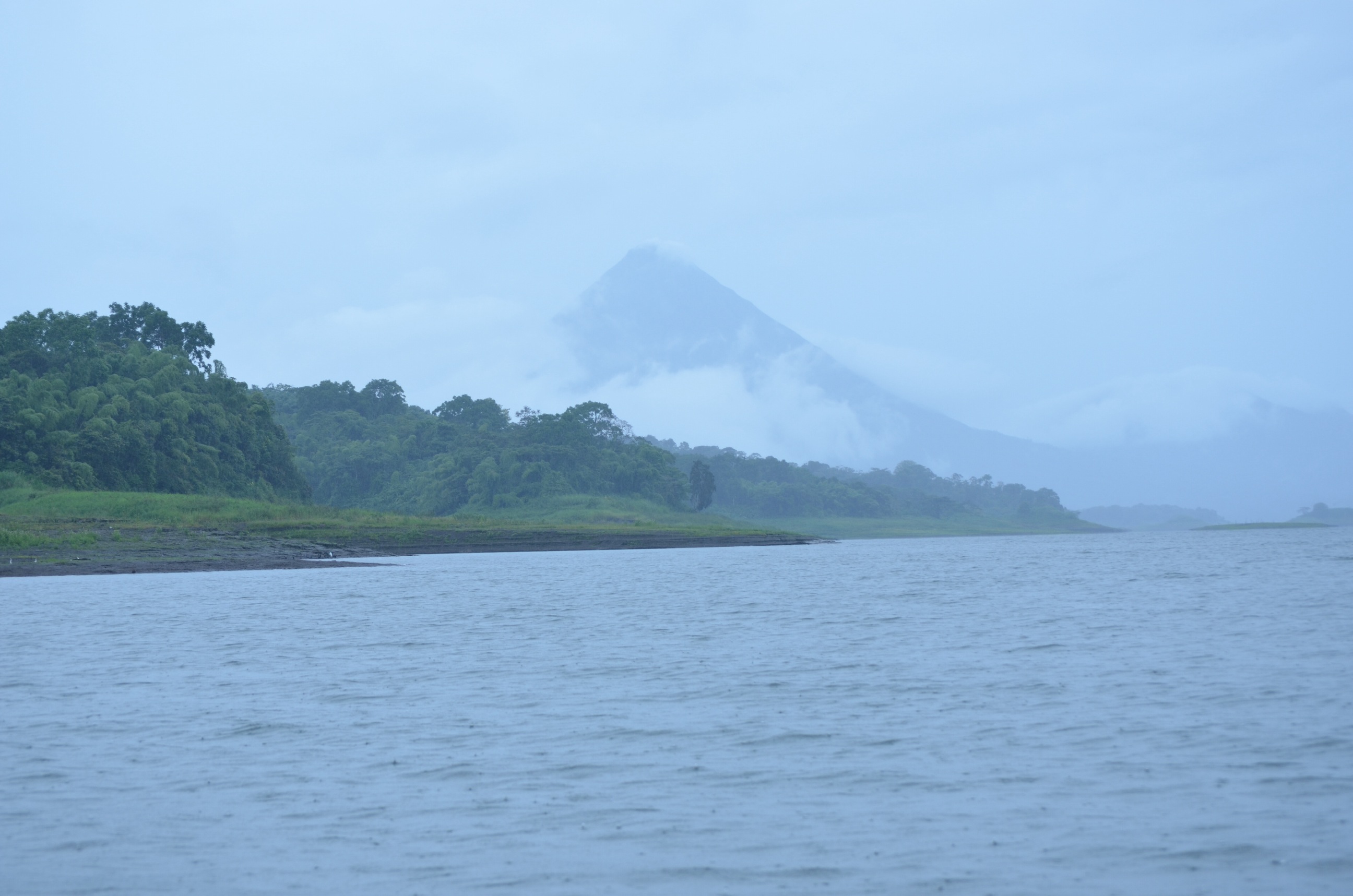
We left our bus and boarded a ferry boat to take us across the lake. Our land trip would continue from the north side of the lake, where we will have to climb up to and cross over the continental divide on our way to our destination in Monteverde. Lake Arena was stocked by the CR government with rainbow bass, tilapia, and fresh water tarpon. The tilapia, not native to CR, have been an ecological challenge and have been out competing the native species for resources. The lake hosts all the species of kingfishers known in the America’s; we saw 2 Ring-necked kingfishers.
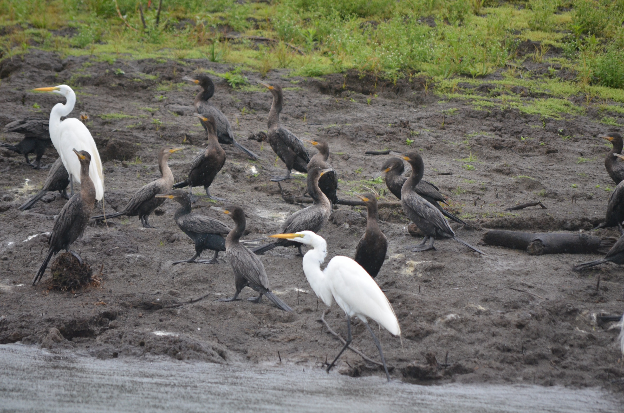
We also observed the anahinga (snake bird), its cousin the cormorant, egrets, and green herons on the shores. In mid-lake the clouds to the south dispersed slightly and we were finally able to get a glimpse of Arenal volcano.
Water of Arenal lake would normally be directed the Caribbean lowlands, however, from the lake it is diverted to the western side of the continental divide, channeled through the Guanacaste providence for irrigation and agricultural use. Main crops that benefit by this irrigation include rice, tilapia, watermelon and cattle. Not sure if studies have been done to examine how this diversion of water affects the Caribbean lowland ecology, but we felt wet all the time we were there in Tortuguera. The lowlands have in excess of 350 cm of rain a year. It seems like they get enough water without The Arenal diversion.
The government owns a corridor circumventing the lake, prohibiting development of the lake from. There are only a few areas of exception where private land approaches the lake.
Our journey across the lake completed after an hour and we disembarked on the north shore of the lake. We then engaged the services of 2 tourist vans to take us the 2 hours up the Tilarán mountain range via gravel road to the town of Sant Elena in Monteverdi.
In 1940, 8 Quaker families settled in the Santa Elena, Monteverde area, originally seeking to establish a religious community. These settlers removed large tracts of forest and developed farm communities. They pretty much have a clear cut policy, to establish their farms. The Monteverde area is classified as Tropical Cloud Forest. In 1968 George Powell, arrived to study ornithology in the Monteverde area. Mr. Powell wanted to study tropical birds in Latin America and he chose CR because it was free of the guerrilla warfare common in several central and South American countries. Powell quickly realized that immediate efforts were necessary to preserve the rich diversity of bird life in the area. He returned to the states and appealed to The Nature Conservancy and World Wildlife Fund for help to establish some protection for the forest and bird species in the Monteverde area. With the help of these organizations, Powell was able to establish a private preserve starting with 8000 hectares. This preserve was then put into the control of the Tropical Science Center a non-profit CR research institution. Additionally, a large tract of land surrounding the preserve is the Children’s Perpetual Rainforest, operated by the Monteverdi conservation group.
We then arrived at the Monteverde Institute in Santa Elena. The Monteverde Institute is a Costa Rican non-profit association dedicated to education, applied research, and community engagement. In partnership with universities and schools around the world, the Institute runs approximately 25 education programs a year, bringing students from abroad. 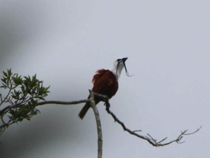
We were given a presentation by Debbie Hamilton, about the history of the Monteverde conservation efforts and the bird research done in this area. Debbie is currently managing a project sponsored by the Local Corridor Council of the Three-Wattled Bellbird Biological Corridor Project. This project seeks to connect critical Pacific-slope habitat between the Monteverde Reserve Complex along the continental divide and coastal mangroves on the Gulf of Nicoya. This initiative hopes to enhance critical altitudinal migratory routes for several species of birds.
Ms. Hamilton, introduced us to part of the garden area of the institute where important forage trees had been replanted, so that we could collect growth data, including height, foliage analysis, and DBH (diameter at breast height). While collecting data we were able to spot a 3 wattles bellbird, the species of concern.
Disclaimer: The views expressed in this blog post are those of the author(s) and do not necessarily reflect the official position of the National Science Teaching Association (NSTA).